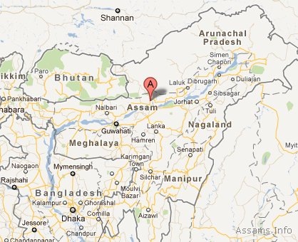
Sonitpur District of Assam
Sonitpur district is one of the administrative districts in Assam. Sonitpur is spread over an area of 5324 sq. kms and is located on the north bank of Brahmaputra river. The District lies between 26° 30’N and 27° 01’N latitude and between 92° 16’E and 93° 43’E longitude. In terms of area Sonitpur is the second largest district of Assam after Karbi Anglong district. The district headquarters of Sonitpur are located at Tezpur.
As per 2011 census, the population of Sonitpur district of Assam is 1,925,975. It has a population density of 365 inhabitants per square kilometer. The sex ratio of Sonitpur district is 946 females for every 1000 males, and it’s literacy rate of 69.96 %.
Located between mighty Brahmaputra River and Himalayan foothills of Arunachal Pradesh, Sonitpur is largely plain with some hills. The district has two national parks: Nameri National Park and Orang National Park, which it shares with Darrang district. Sonitpur is also the home of wo wildlife sanctuaries: Burachapori and Sonai-Rupai.

Tourist Attractions in Sonitpur:
- Tezpur: A beautiful and multifaceted city with archaeological sites, hills, lakes and gardens.
- Chitralekha Udyan: Beautiful garden with ornamental stone pillars, sculptural relics, water sports facility, lush green walkways and a small amphitheatre.
- Agnigarh hill: Memorial of eternal romance. Has a landscape garden with exquisite sculptures, spectacular view of the Brahmaputra and Kalia Bhomora bridge.
- Mahabhairab Temple: Has one of the biggest and oldest Shivalingas of the world.
- Da – Parbatia: One of the finest and oldest specimen of sculptural art in Assam
- Padum Pukhuri: A lotus pond with a central island.
- Nameri National Park: A national park known for whitewinged wood duck (Deo Hanh), black bear, deer and elephants etc.
- Kolia Bhomora Bridge: A 3.015 km long road bridge over river Brahmaputra. It connects Sonitpur district with Nagaon district of Assam.
Map of Sonitpur, Assam:
[googlemap width="614" height="400" src="http://maps.google.com/maps?t=m&vpsrc=0&ie=UTF8&ll=26.667096,92.801514&spn=0.490884,0.841827&z=10"]
