
Kamrup District, Assam
Kamrup is a district in Assam. It occupies an area of 4,345 square km and lies between 25°46′ to 26°49′ North Latitude and 90°48′ to 91°50′ East Longitude. Kamrup is surrounded by Udalguri and Baksa districts on North; MDarrang and Kamrup Metropolitan district on East; Meghalaya state on South and Goalpara and Nalbari districts on West. The district comprises two sub- divisions namely, Guwahati and Rangia. District headquarters of Kamrup are located at Guwahati.
People:
Kamrup district of Assam shelters a population of 1,517,202 (2011 India Census). The population density in the district is 436 inhabitants per square km, while sex ratio is 946 females per 1000 males. The literacy rate in Kamrup district of Assam is 72.81%. Major languages spoken in the district are Kamrupi and Assamese.
Climate:
The climate of Kamrup district is sub-tropical with cold winter and semi-dry summer. Average annual rainfall received in the district ranges from 1500 mm to 2600 mm. Annual temperate range in the district varies from 7° to 38.5°C. Average humidity is 75%.
Connectivity:
Kamrup district is well connected via road, railway and air. Nearest International airport is in Borjhar, Guwahati.
Places of Tourist Interest:
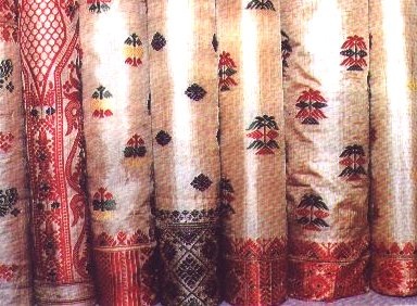
- Sualkuchi
- Daul Govidha Mandir
- Madan Kamdev Temple
- Hayagriva-Madhab Mandir
- Poa Macca
- Aswaklanta Temple
- Dirgheswari Temple
- Sidheswar Devalaya
- Chanddubi
- Dipar beel
- Chanda’s Merghar at Chaygaon
- Saraighat Bridge
- Saraighat War Memorial Park