
Jorhat District, Assam, India
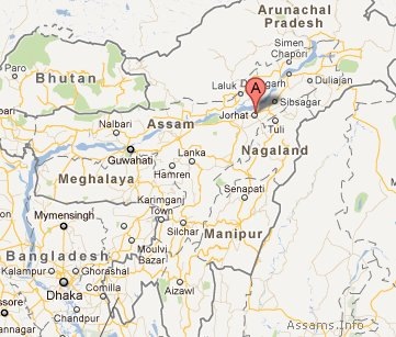
Jorhat district of Assam is located between 26°46′ North latitude and 94°16′ East longitude. It has river Brahmaputra on North, Sibsagar district on East, Nagaland state on South and Golaghat district on West. The area of Jorhat district is 2852 Sq. Km. and population is 1,091,295 (as per 2011 Census). The population comprises predominantly Hindus and Muslims. Jorhat district in Assam has a high literacy rate of 83.42 %.
History:
The name Jorhat or "Jorehaut" means two (jor) marts or mandis (hut). The name’s origin is related with the two parallel marts (Chowkihut and Macharhut) on the eastern and the western banks of the river Bhogdoi. Towards end of 18th century, Jorhat served as the last capital of the Ahom Kingdom. The Jorhat town had grown into a commercial metropolis until it was destroyed by a series of Burmese invasions since 1817.
Earlier Jorhat was a sub-division of undivided Sibsagar District. In 1983 Jorhat was curved out of Sibsagar district. The present Jorhat district consists of three sub-divisions: Jorhat, Majuli and Titabor. The district is devided into 6 revenue circles and 8 development blocks. There are six legislative assemblies in Jorhat district: Jorhat, Titabor, Mariani, Teok, Dergaon and Majuli.
Places to Visit:
- Majuli: A large river island in Brahmaputra.
- Dhekiakhowa Bornamghar: A famous Bor namghar (place of worship) established by saint-reformer Madhabdev in 1461.
- Lachit Borphukan’s Maidam: The maidam of great Ahom General Lachit Borphukan.
- Raja Maidam: Maidam of king Purandar Sinha.
- Jorhat Gymkhana Club: Horse racecourse with 9-hole golf course.
- Gibbon Wildlife Sanctuary: Home of Hoolock gibbons (Hoolock hoolock).
- Tocklai Tea Research Centre