
Tinsukia District of Assam
Tinsukia is a district of Assam state, India. The Tinsukia Sub-Division of un-divided Dibrugarh District was declared as the 23rd district of Assam on 1st of October, 1989. Located in upper Assam, this district of consists of three sub-divisions: Tinsukia (Sadar), Margherita and Sadiya. Tinsukia district occupies an area of 3,790 square kilometres (1,460 sq mi). As per 2011 census, the population of Tinsukia is 1,316,948 and population density is 303 /km2. Sex ratio is 948 and literacy rate is 70.92. Major communities of the district are Ahoms, Tea tribes, Moran, Muttock, Singpho, Bihari, Nepali, Bengali etc.
Tinsukia is an industrial district. But it also produces a sizeable amount of Tea, Oranges, Ginger, Citrus fruits and rice. Majority of its population are cultivators and agricultural workers. The Oldest oil refinery in India is situated at Digboi in Tinsukia district. Margherita and Ledo of this district is famous for open cast coal mining. Another attraction of this upper Assam district is the Dibru-Saikhowa National Park, which is famous for several rare and endangered wildlife species.
Tinsukia History
The ancient name of Tinsukia was Bangmara which was orginally known as Changmai Pathar. It was the capital of Muttack Kingdom. The Bangmara city was built by King Sarbananda Singha with the help of his Minister Gopinath Barbaruah alies Godha. The city was built in the middle of the present Tinsukia City (near the Senairam H.S. School).
As per the direction of Sarbananda Singha, Godha Baruah dug a triangler shaped pond in Bangmara which is known as "Tinikunia Pukhuri". In 1884 Dibru-Sadiya Rail line was constructed and a station was setup near the "Tinikunia Phukhuri" which was named as Tinsukia. Since then the City was popularly known as Tinsukia.
The muttack Kingdom occupied a distinct place in the history of Assam during the later part of the 18th century and the early part of 19th century. The Moamareeyas or the Muttacks turned the history of the mighty Ahom Kingdom by leading the historic Moamareeya Rebellion, which may be described as the first socio-political movement in the history of Assam.
According to the map prepared by Captain Hemilton Vetch in 1841, a large portion of present Dibrugarh and Tinsukia district had been identified as "Bengmara Country of Moamareeya Tribe" with its capital at Bengmara (present Tinsukia). In the history of Assam, this Bengmara Country was later popularly known as Muttack Country of Soumar, early name of a region in the North East corner of Assam.
Location and Connectivity
Tinsukia is well connected by national highway, railway and air. It’s distance from state capital Dispur is 532km. National high 37 connects Tinsukia with other major cities including Guwahati, Nagaon, Jorhat and Dibrugarh. The nearest Airport is Mohanbari (Dibrugarh), which is about 40km away from Tinsukia. Several trains connects Tinsukia with other towns and cities of India.
Tinsukia Attractions
Popular tourist attraction in Tinsukia include Dibru Saikhowa National Park, Digboi, Margherita, War Cemetery, National Oil Park etc. Major towns in this district include Tinsukia, Digboi, Margherita, Doomdooma and Makum.
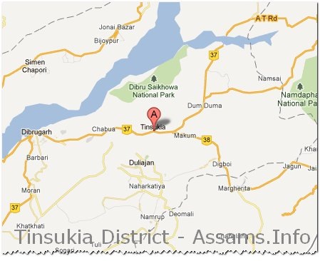
Map of Tinsukia, Assam:
[googlemap width="614" height="400" src="http://maps.google.co.in/maps?q=tinsukia+map&hl=en&client=firefox-a&ie=UTF8&hq=&hnear=Tinsukia,+Assam&t=m&vpsrc=6&ll=27.489999,95.359955&spn=0.487293,0.843201&z=10"]